
Use various filter options from the map toolbar to create focused maps of Vessels and Orders
To achieve a tailored map view there are 2 sets of map toolbars available to help create this:
- Vertical Map Toolbar
- Horizontal Map Toolbar
1. Vertical Map Toolbar - is located on the right side of a map tab.
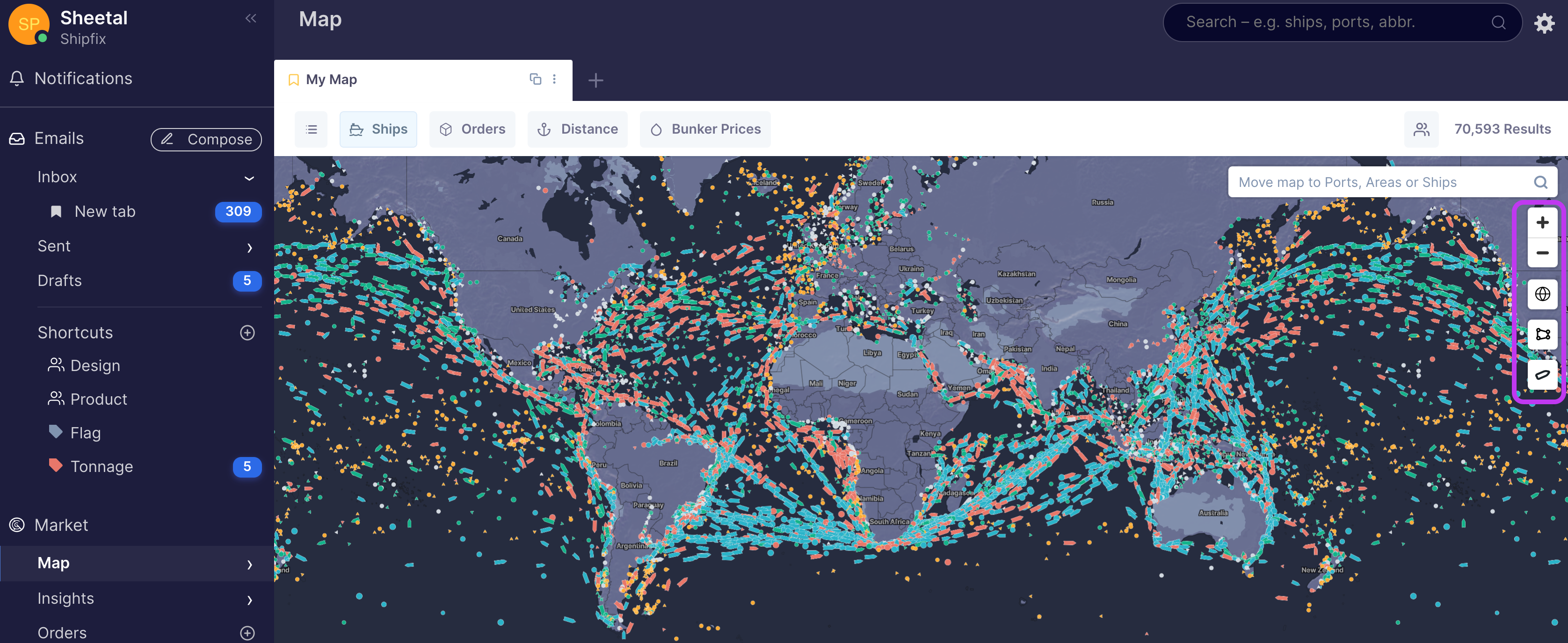
The Vertical map toolbar offers a combination of filters and action icons as described in the table below:
| Icon | Name | Description |
| search filter |
Allows you to search for, a desired port an area/region a specific vessel on the map, click on it and your map will 'zoom in' to your selection |
|
| zoom in/out | zoom in or out on areas of the map (you can also scroll to zoom in/out) | |
| satellite view | change the map to a satellite view | |
| polygon drawer | draw a polygon around areas of the map you want to focus on | |
| vessel sizer | enlarge or reduce the size of vessel icon(s) displayed on the map |
2. Horizontal Map Toolbar - is located on the top of a map tab.
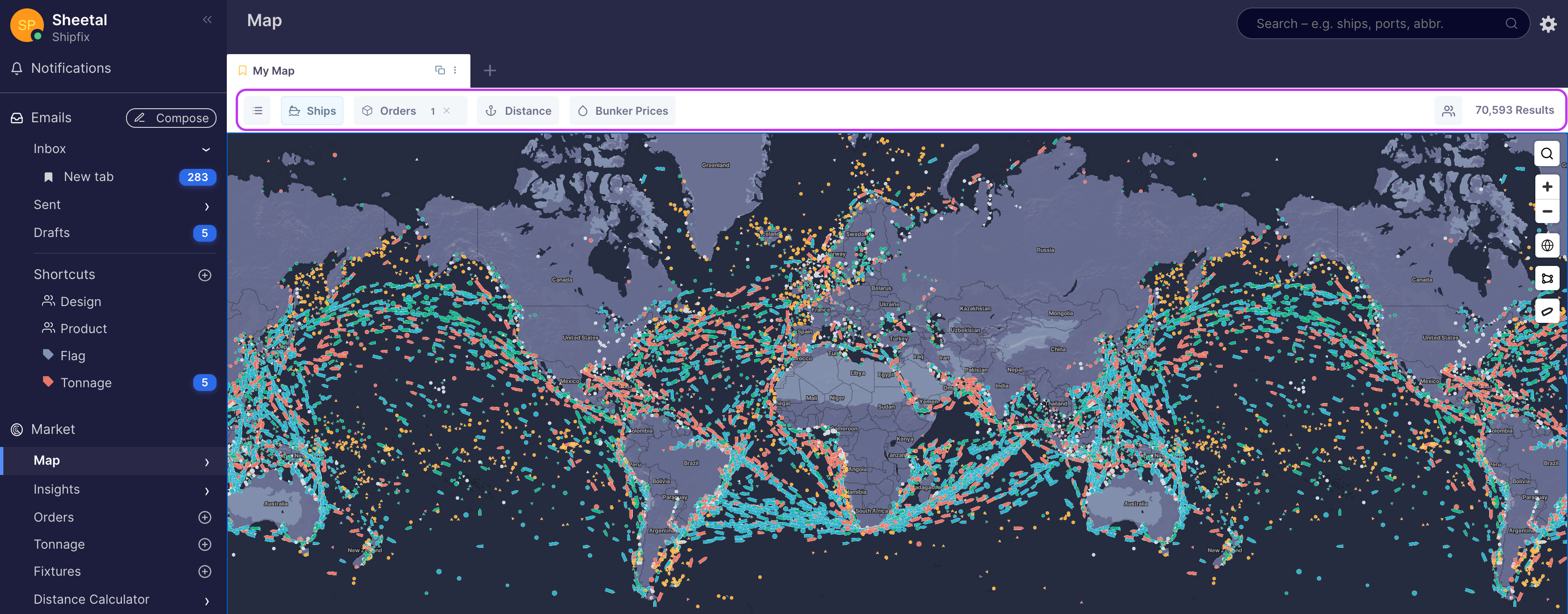
The horizontal map toolbar offers various filters and action icons as described below:
| Icon | Name | Description |
 |
List View | provides a list of vessels or orders that are in your map view |
 |
Ships Filters |
Provides 3 main filter categories: i. Ship Type ii. Ship 'Specifications' iii. Enable Advertised Ships |
 |
Order Heatmap | Provides a heat-map displaying the propensity of orders on your system from their loading area |
 |
Distance Calculator | offers a quick distance calculation of vessels on your map to specified port |
 |
Bunker Prices | Is a quick link to the Shipfix Bunker Directory |
 |
Share tab | Enables you to share a map tab with colleague(s) |
Comments
0 comments
Article is closed for comments.